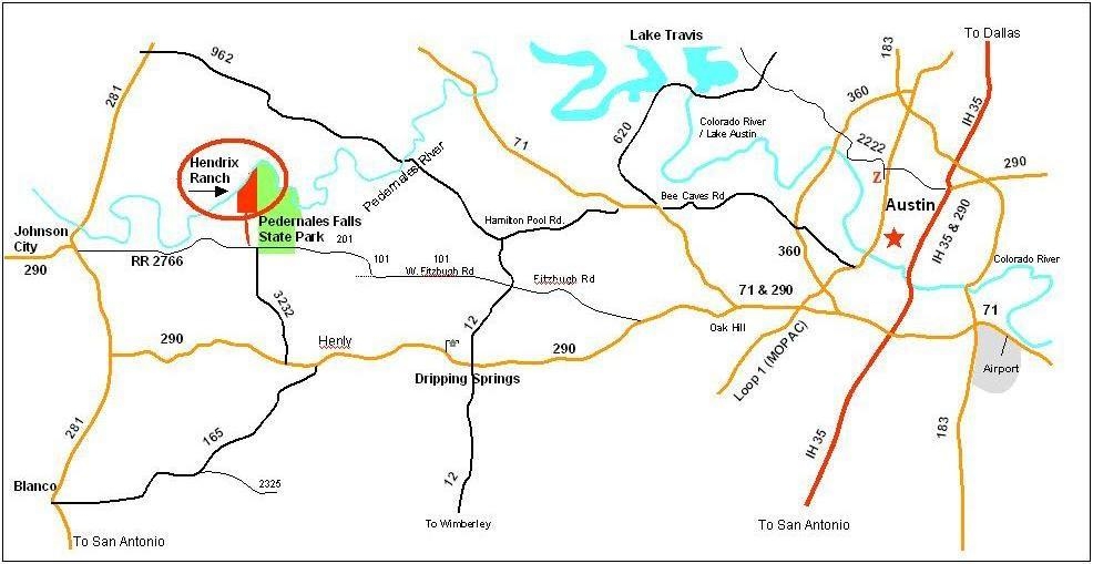
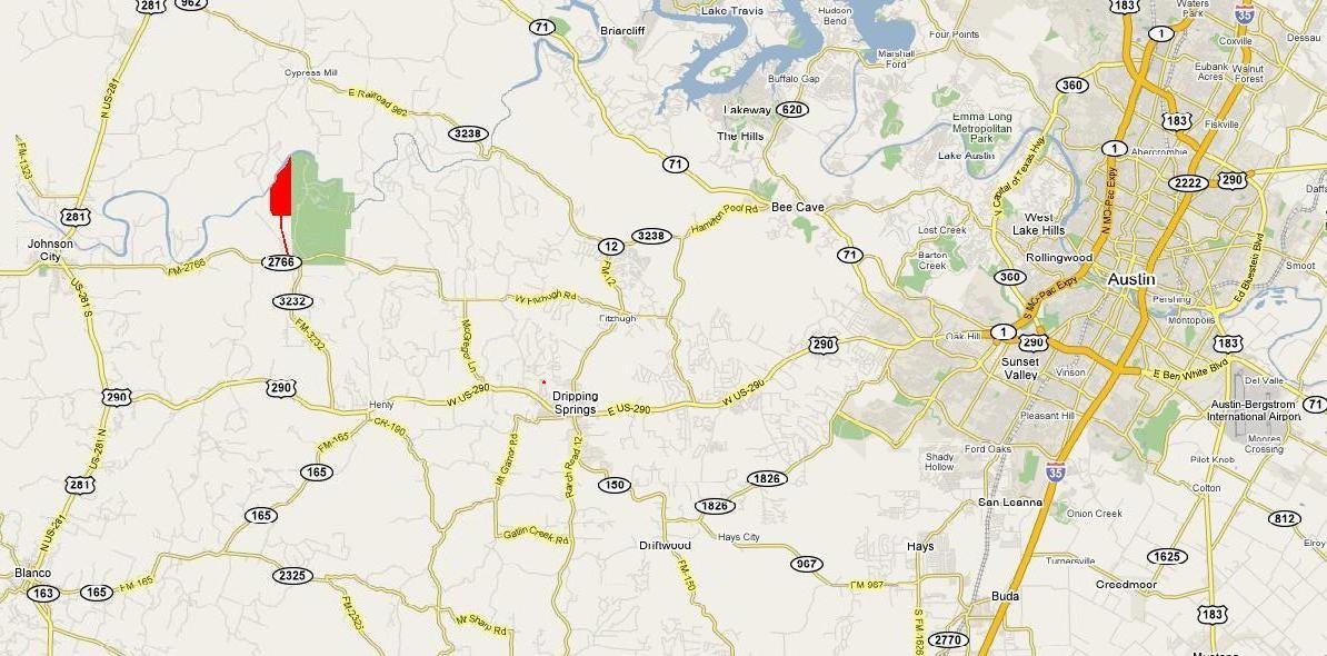
Getting to the Ranch
Interactive Google Map of the ranch with various points of interest.
Getting Around on the Ranch
To the Field and West Park from the Front Gate
Short: Follow the crushed-rock road and keep left at the Y.
Long: As you enter the front gate, set your odometer to 0 and follow the unpaved ranch road. To avoid damage to the ranch road, please drive slowly.
- The first 1.8 miles of the ranch are only 100 feet wide. After 1.8 miles, the ranch broadens a bit to include a grove of post oaks.
- At 2.3 miles, the ranch reaches its full width and you can see the high fence turning off to the right up the hill. That fence is the southern boundary of the main portion of the ranch.
- At 2.6 miles, there is a sharp curve to the right. After making the curve, you will see the ranch's open field/pasture to the left, and a forest of cedar and oak to the right.
- At 3.0 miles, you come to the end of the field, and make a sharp turn to the left through the middle gate, which is decorated with a rusty metal sculpture of a man in a bow tie.
- At 3.1 miles, you reach the Y.
- Take the left (west) fork at the Y.
- At 3.4 miles, the road turns sharply to the left at the corner of the field. This is the best spot to access the field.
- Continuing along the road, the West Park is on the right at 3.7 miles.
- At the end of the road is a steep hill down to the benchlands area along the river.
To the Gazebo from the Front Gate
As you enter the front gate, set your odometer to 0. Take the right (east) branch of the Y at 3.1 miles. (See above for detailed directions to the Y.) This takes you onto a dirt road. At 4.4 miles, there is another road turning off to the right; this goes towards the zen view spot, not the gazebo. Soon after that intersection, the gazebo road takes a sharp bend to the left. The gazebo parking lot is at 4.5 miles.
Warning: After the Y, the gazebo road is just dirt. When it is dry, this is part of the road is ok for most cars, but after a rain it turns to mud and four-wheel drive is recommended.